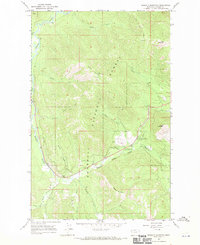
1966 Map of Kenelty Mountain
USGS Topo · Published 1970About this map
The Kootenai National Forest dominates this mid-1960s landscape, centered on the drainage systems of the Fisher River and the Silver Butte River. The terrain is defined by prominent peaks, including Kenelty Mountain which features a Lookout Tower, alongside Fritz Mountain and Wapiti Mountain. Resource management and early recreation patterns are evident through the presence of the Raven Ranger Station and several dispersed recreational sites such as Pleasant Valley Park and the Lyons Spring Campground.
Find a feature on this map
40 named features on this map. Tap any name to fly to it.
Don’t see what you’re looking for? This feature index may not catch every label — zoom into the map to look around manually.
Map Details
Editions of this 1966 Kenelty Mountain Map
2 editions found
Other maps of this area

1920 · Jennings
USGS Topo · 1:125,000

1935 · Thompson Lakes
USGS Topo · 1:96,000

1937 · Thompson Falls
USGS Topo · 1:125,000

1942 · Thompson Lakes
USGS Topo · 1:125,000

1956 · Wallace
USGS Topo · 1:250,000

1957 · Kalispell
USGS Topo · 1:250,000

1960 · Kalispell
USGS Topo · 1:250,000

1960 · Wallace
USGS Topo · 1:250,000

1961 · Kalispell
USGS Topo · 1:250,000
1966 · Horse Mountain
USGS Topo · 1:24,000