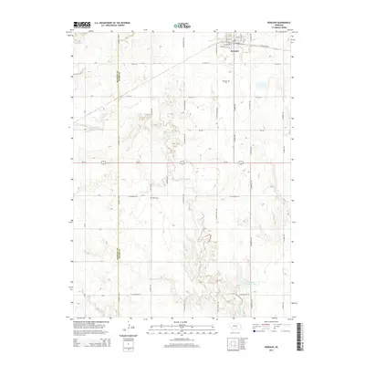
2014 Map of Kenesaw
USGS Topo · Published 2014About this map
Kenesaw serves as the primary hub in this portion of the Nebraska plains, positioned along a grid of section roads that define the agricultural landscape. The village itself is detailed down to street-level names like W Kenesaw Blvd and W Elm St, indicating a stable residential core surrounded by vast acreage. Outside the town limits, the landscape is shaped by the winding path of Cottonwood Cr, which cuts through the terrain toward the south, eventually reaching the privately named Shurigar Brothers Lake.
Find a feature on this map
41 named features on this map. Tap any name to fly to it.
Don’t see what you’re looking for? This feature index may not catch every label — zoom into the map to look around manually.
Map Details
Editions of this 2014 Kenesaw Map
This is the sole edition of this map. No revisions or reprints were ever made.
Other maps of this area

1894 · Kenesaw
USGS Topo · 1:62,500

1894 · Minden
USGS Topo · 1:62,500

1896 · Wood River
USGS Topo · 1:125,000

1897 · Red Cloud
USGS Topo · 1:125,000

1955 · Grand Island
USGS Topo · 1:250,000

1957 · Grand Island
USGS Topo · 1:250,000

1958 · Grand Island
USGS Topo · 1:250,000

1962 · Denman
USGS Topo · 1:24,000

1962 · Prosser
USGS Topo · 1:24,000
1962 · Gibbon South
USGS Topo · 1:24,000