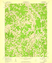
1957 Map of Kenna
USGS Topo · Published 1959About this map
Kenna sits at the junction of Grasslick Road and the valley paths in this 1950s study of Jackson County. The landscape is defined by a dense network of hollows and ridges, such as Brotherton Ridge and Washington Ridge, which dictated the placement of early settlements and isolated community institutions. Notable for genealogists are the numerous rural houses of worship, including Parchment Chapel, Ephesus Ch, and Warren Chapel, often located near family-named landmarks like Garnes Knob or Hall Knob.
Find a feature on this map
91 named features on this map. Tap any name to fly to it.
Don’t see what you’re looking for? This feature index may not catch every label — zoom into the map to look around manually.
Map Details
Editions of this 1957 Kenna Map
2 editions found
Other maps of this area

1906 · Kenna
USGS Topo · 1:62,500

1906 · Winfield
USGS Topo · 1:62,500

1907 · Kenna
USGS Topo · 1:62,500

1907 · Ripley
USGS Topo · 1:62,500

1908 · Winfield
USGS Topo · 1:62,500

1908 · Ravenswood
USGS Topo · 1:62,500

1926 · Ravenswood
USGS Topo · 1:62,500

1926 · Ripley
USGS Topo · 1:62,500

1928 · Ravenswood
USGS Topo · 1:62,500

1928 · Ripley
USGS Topo · 1:62,500