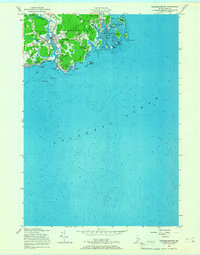
1956 Map of Kennebunkport
USGS Topo · Published 1966About this map
Kennebunkport and the Lower Village are defined by the winding course of the Kennebunk River as it reaches the Atlantic Ocean in this mid-century topographic study. The landscape reflects a mix of maritime heritage and early coastal leisure, with the Webhannet Golf Course and an Athletic Field established near the residential clusters of Wildes Corner and the Wildes District.
Find a feature on this map
42 named features on this map. Tap any name to fly to it.
Don’t see what you’re looking for? This feature index may not catch every label — zoom into the map to look around manually.
Map Details
Editions of this 1956 Kennebunkport Map
4 editions found
Other maps of this area

1891 · Biddeford
USGS Topo · 1:62,500

1891 · Kennebunk
USGS Topo · 1:62,500

1893 · Kennebunk
USGS Topo · 1:62,500

1893 · York
USGS Topo · 1:62,500

1893 · Biddeford
USGS Topo · 1:62,500

1898 · Kennebunk
USGS Topo · 1:62,500

1920 · York
USGS Topo · 1:62,500

1941 · Biddeford
USGS Topo · 1:62,500

1941 · Kennebunk
USGS Topo · 1:62,500

1944 · Wells
USGS Topo · 1:24,000