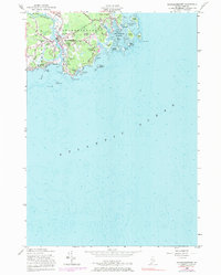
1956 Map of Kennebunkport
USGS Topo · Published 1983About this map
The coastal village of Kennebunkport is meticulously documented in this mid-century update, showcasing a landscape defined by the winding Kennebunk River and a complex shoreline of coves and islands. The settlement pattern reveals the historic core at Lower Village and Coopers Corner, connected to the sea via Ocean Avenue and the rocky protrusions of Cape Arundel. Maritime history is etched into the map through the Lighthouse on Goat Island and the shelter of Cape Porpoise Harbor.
Find a feature on this map
49 named features on this map. Tap any name to fly to it.
Don’t see what you’re looking for? This feature index may not catch every label — zoom into the map to look around manually.
Map Details
Editions of this 1956 Kennebunkport Map
4 editions found
Other maps of this area

1891 · Biddeford
USGS Topo · 1:62,500

1891 · Kennebunk
USGS Topo · 1:62,500

1893 · Kennebunk
USGS Topo · 1:62,500

1893 · York
USGS Topo · 1:62,500

1893 · Biddeford
USGS Topo · 1:62,500

1898 · Kennebunk
USGS Topo · 1:62,500

1920 · York
USGS Topo · 1:62,500

1941 · Biddeford
USGS Topo · 1:62,500

1941 · Kennebunk
USGS Topo · 1:62,500

1944 · Wells
USGS Topo · 1:24,000