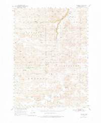
1950 Map of Kennedy
USGS Topo · Published 1976About this map
The Snake River winds through the heart of this Sandhills landscape, creating a distinct riparian corridor marked by Snake River Falls and the Falls Bridge. Much of the northern terrain is defined by the Nebraska National Forest, while the south-central portion centers on the small community of Kennedy and the adjacent, uniquely named Tiny Town. This 1950 field check captures a transition in rural education and land use, showing localized landmarks like Merry Land Park Sch alongside established cattle operations such as Swanson Ranch and Piercy Ranch. The presence of numerous watering points like Windmill Lake and the marshy Swanson Swamp emphasizes the region's reliance on groundwater for ranching. Several early twentieth-century schools, including School No 68 and School No 90, remain scattered across the townships, providing specific points of interest for genealogists tracing families in the Geria, Cleveland, and Kennedy districts.
Find a feature on this map
25 named features on this map. Tap any name to fly to it.
Don’t see what you’re looking for? This feature index may not catch every label — zoom into the map to look around manually.
Map Details
Editions of this 1950 Kennedy Map
2 editions found
Other maps of this area

1949 · Big Falls
USGS Topo · 1:62,500

1950 · Simeon
USGS Topo · 1:62,500

1950 · Powderhorn Valley
USGS Topo · 1:62,500

1950 · Kennedy
USGS Topo · 1:62,500

1950 · Kilgore
USGS Topo · 1:62,500

1950 · Valentine
USGS Topo · 1:62,500

1950 · Cody
USGS Topo · 1:62,500

1951 · Big Falls
USGS Topo · 1:62,500

1951 · Bull Lake
USGS Topo · 1:62,500

1951 · Brownlee
USGS Topo · 1:62,500