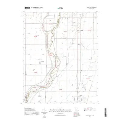
2017 Map of Kennett North
USGS Topo · Published 2017About this map
The Saint Francis River winds through the borderlands of Missouri and Arkansas, creating a landscape defined by braided waterways and agricultural tracts. This 2017 survey shows the northern reaches of Kennett alongside the state line, where the river separates Dunklin County, Missouri from Clay County, Arkansas. Notable river features include Sevenmile Island and Ten Mile Island, which sit amidst a network of drainage ditches and sloughs like Shipley Slough and Lateral Number 2. Small, dispersed settlements such as Nimmons, Carryville, and White Oak are connected by a grid of county roads, reflecting the region's rural development. Genealogists will find several burial sites preserved on the landscape, including Nimmons Cem, McCulley Cem, and Gregory Cem, providing clear evidence of the community's ancestral footprint in the Bootheel region.
Find a feature on this map
86 named features on this map. Tap any name to fly to it.
Don’t see what you’re looking for? This feature index may not catch every label — zoom into the map to look around manually.
Map Details
Editions of this 2017 Kennett North Map
This is the sole edition of this map. No revisions or reprints were ever made.
Other maps of this area

1934 · Kennett
USGS Topo · 1:62,500

1940 · Pascola
USGS Topo · 1:62,500

1940 · Kennett
USGS Topo · 1:62,500

1940 · Hayti
USGS Topo · 1:62,500

1940 · Piggott
USGS Topo · 1:62,500

1955 · Pascola
USGS Topo · 1:62,500

1955 · Hayti
USGS Topo · 1:62,500

1956 · Kennett
USGS Topo · 1:62,500

1956 · Piggott
USGS Topo · 1:62,500

1956 · Dyersburg
USGS Topo · 1:250,000