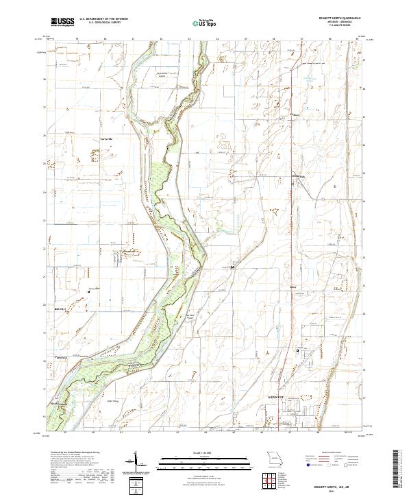
2021 Map of Kennett North
USGS Topo · Published 2021About this map
The Saint Francis River forms a significant natural and political boundary in this low-lying region, carving out Sevenmile Island and Ten Mile Island as it defines the border between Arkansas and Missouri. The landscape is dominated by a complex network of drainage features such as Indian Camp Slough, Shipley Slough, and Lateral Number 2, which suggest an area heavily engineered for agricultural use. Settlements are scattered throughout this alluvial plain, including the northern portions of Kennett and the town of Nimmons. Local history is preserved in several small burial grounds like Nimmons Cem and Gregory Cem, while small communities such as White Oak and Frisbee serve as landmarks along the section lines and rural road grids that organize the terrain east of the river.
Find a feature on this map
82 named features on this map. Tap any name to fly to it.
Don’t see what you’re looking for? This feature index may not catch every label — zoom into the map to look around manually.
Map Details
Editions of this 2021 Kennett North Map
This is the sole edition of this map. No revisions or reprints were ever made.
Other maps of this area

1934 · Kennett
USGS Topo · 1:62,500

1940 · Pascola
USGS Topo · 1:62,500

1940 · Kennett
USGS Topo · 1:62,500

1940 · Hayti
USGS Topo · 1:62,500

1940 · Piggott
USGS Topo · 1:62,500

1955 · Pascola
USGS Topo · 1:62,500

1955 · Hayti
USGS Topo · 1:62,500

1956 · Kennett
USGS Topo · 1:62,500

1956 · Piggott
USGS Topo · 1:62,500

1956 · Dyersburg
USGS Topo · 1:250,000