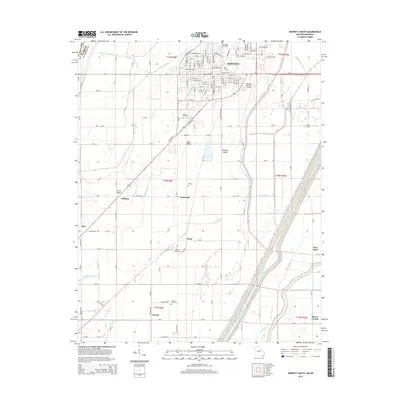
2015 Map of Kennett South
USGS Topo · Published 2015About this map
Kennett serves as the focal point for this survey of the Missouri Bootheel, revealing a landscape defined by an extensive reclamation network of canals and ditches. The Little River and its accompanying Ditch Number 259 dominate the eastern portion of the quadrangle, illustrating the massive hydrological engineering required to drain this fertile low country. Surrounding the city, a pattern of dispersed agricultural settlements includes Dillman, Vincit, and Caruth, many of which are connected by a rigorous grid of county roads such as Co Road 549 and Co Road 522. This layout reflects the mid-20th-century evolution of the region's farming economy. Local history is anchored by several notable burial grounds, including Oak Ridge Cemetery near the city center and the more isolated Rogers Cemetery and Liberty Cemetery to the south. These sites, along with landmarks like Kennett Memorial Airport, provide essential points of reference for genealogists and researchers tracking family movements through Dunklin County.
Find a feature on this map
134 named features on this map. Tap any name to fly to it.
Don’t see what you’re looking for? This feature index may not catch every label — zoom into the map to look around manually.
Map Details
Editions of this 2015 Kennett South Map
This is the sole edition of this map. No revisions or reprints were ever made.
Other maps of this area

1934 · Kennett
USGS Topo · 1:62,500

1940 · Pascola
USGS Topo · 1:62,500

1940 · Kennett
USGS Topo · 1:62,500

1940 · Hayti
USGS Topo · 1:62,500

1940 · Piggott
USGS Topo · 1:62,500

1955 · Pascola
USGS Topo · 1:62,500

1955 · Hayti
USGS Topo · 1:62,500

1956 · Kennett
USGS Topo · 1:62,500

1956 · Piggott
USGS Topo · 1:62,500

1956 · Dyersburg
USGS Topo · 1:250,000