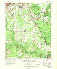
1967 Map of Kensett
USGS Topo · Published 1967About this map
The Little Red River defines the northern reaches of this mid-1960s survey, winding past West Point and the Riverside Cem before entering a complex network of sloughs and brakes. The landscape is a study in transition between the expanding town of Searcy and the agrarian wetlands of the Lower Mississippi Valley Division. Genealogists will find a wealth of rural landmarks, including Ellis Chapel, Morrow Ch, and the Gum Springs Cem.
Find a feature on this map
105 named features on this map. Tap any name to fly to it.
Don’t see what you’re looking for? This feature index may not catch every label — zoom into the map to look around manually.
Map Details
Editions of this 1967 Kensett Map
This is the sole edition of this map. No revisions or reprints were ever made.
Other maps of this area

1932 · Kensett
USGS Topo · 1:62,500

1935 · Kensett
USGS Topo · 1:62,500

1935 · Hazen
USGS Topo · 1:62,500

1935 · Augusta
USGS Topo · 1:62,500

1935 · Gregory
USGS Topo · 1:62,500

1935 · Bald Knob
USGS Topo · 1:62,500

1940 · Lonoke
USGS Topo · 1:62,500

1941 · Hazen
USGS Topo · 1:62,500

1941 · De Valls Bluff
USGS Topo · 1:62,500

1948 · Helena
USGS Topo · 1:250,000