
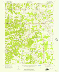
1956 Map of Kent
USGS Topo · Published 1957About this map
The Baltimore And Ohio railroad cuts a diagonal path through this 1950s landscape, connecting the agricultural communities of Lexington and Kent. This region of southern Indiana is defined by a dense network of watercourses, including Fourteenmile Creek and Town Rock Creek, which have carved intricate drainages into the terrain. The map reveals a deeply established rural social fabric, marked by small settlements like Swanville and Chelsea, alongside numerous country institutions. Local family history is preserved through a significant concentration of burial grounds, such as Blankenship Cem, Landon Cem, and Slippery Point Cem. Unusual geological features are also present, with Slider Cave and Morris Cave noted in the northern sections, while a Quarry near Hanover indicates local industrial activity. The presence of Liberty Ch and the Pleasant Point Sch highlights the community hubs that served these farming townships.
Find a feature on this map
38 named features on this map. Tap any name to fly to it.
Don’t see what you’re looking for? This feature index may not catch every label — zoom into the map to look around manually.
Map Details
Editions of this 1956 Kent Map
4 editions found
Other maps of this area

1939 · Bethlehem
USGS Topo · 1:24,000

1939 · Madison West
USGS Topo · 1:24,000

1948 · Bethlehem
USGS Topo · 1:24,000

1948 · Madison West
USGS Topo · 1:24,000

1953 · Madison West
USGS Topo · 1:24,000

1953 · Bethlehem
USGS Topo · 1:24,000

1956 · Otisco
USGS Topo · 1:24,000

1956 · Volga
USGS Topo · 1:24,000

1956 · Blocher
USGS Topo · 1:24,000

1956 · Deputy
USGS Topo · 1:24,000