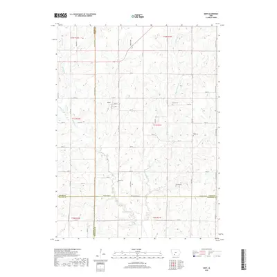
2018 Map of Kent
USGS Topo · Published 2018About this map
Kent serves as a central point of reference in this corner of southwestern Iowa, where the landscape is defined by the headwaters and drainage of the W Platte River. Situated near the intersection of several county lines, the map reveals the persistent section-line grid of the Public Land Survey System that organizes the agricultural terrain. This 2018 edition provides a look at the modern rural layout where Union and Adams counties meet, reflecting a long history of prairie cultivation. The drainage patterns of the W Platte River and its various tributaries dictate the local topography, carving shallow valleys through the upland farm country.
Find a feature on this map
3 named features on this map. Tap any name to fly to it.
Don’t see what you’re looking for? This feature index may not catch every label — zoom into the map to look around manually.
Map Details
Editions of this 2018 Kent Map
This is the sole edition of this map. No revisions or reprints were ever made.
Other maps of this area

1954 · Omaha
USGS Topo · 1:250,000

1955 · Nebraska City
USGS Topo · 1:250,000

1957 · Nebraska City
USGS Topo · 1:250,000

1957 · Omaha
USGS Topo · 1:250,000

1958 · Omaha
USGS Topo · 1:250,000

1958 · Nebraska City
USGS Topo · 1:250,000

1980 · Merle Junction
USGS Topo · 1:24,000

1980 · Lenox
USGS Topo · 1:24,000

1980 · Creston East
USGS Topo · 1:24,000
1980 · Prescott
USGS Topo · 1:24,000