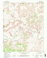
1968 Map of Kenton
USGS Topo · Published 1988About this map
Kenton sits at a geographic crossroads in the Oklahoma Panhandle, where the high plains meet the distinctive volcanic plateau of Black Mesa. This 1968 field-checked landscape captures the settlement's relationship with the Cimarron River and its various tributaries, including Carrizozo Creek and Tesesquite Creek. The map documents a rugged borderland environment where the Comanche National Grassland and Black Mesa State Park preserve significant terrain features like Robbers Roost Peak. Local history is anchored by the Kenton Cem and early transportation routes such as Coopers Trail and the primitive Canyon Road. The presence of a Gaging Sta on the river underscores the importance of water management in this arid transition zone near the New Mexico and Colorado borders.
Find a feature on this map
21 named features on this map. Tap any name to fly to it.
Don’t see what you’re looking for? This feature index may not catch every label — zoom into the map to look around manually.
Map Details
Editions of this 1968 Kenton Map
3 editions found
Other maps of this area

1891 · Springfield
USGS Topo · 1:125,000

1892 · Mt Carrizo
USGS Topo · 1:125,000

1893 · Springfield
USGS Topo · 1:125,000

1954 · Dalhart
USGS Topo · 1:250,000

1955 · La Junta
USGS Topo · 1:250,000

1958 · La Junta
USGS Topo · 1:250,000

1958 · Dalhart
USGS Topo · 1:250,000

1962 · Dalhart
USGS Topo · 1:250,000

1968 · La Junta
USGS Topo · 1:250,000

1968 · Kenton
USGS Topo · 1:24,000