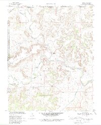
1968 Map of Kenton
USGS Topo · Published 1988About this map
Kenton sits at the heart of this Panhandle survey, marking a significant intersection of geography and statehood where the borders of Oklahoma, Colorado, and New Mexico converge. The landscape is defined by the massive plateau of Black Mesa, which stretches across the western portion of the sheet. This area, including Black Mesa State Park, is characterized by dramatic topographic relief, with prominent points like Robbers Roost Peak overlooking a complex network of waterways.
Find a feature on this map
21 named features on this map. Tap any name to fly to it.
Don’t see what you’re looking for? This feature index may not catch every label — zoom into the map to look around manually.
Map Details
Editions of this 1968 Kenton Map
3 editions found
Other maps of this area

1891 · Springfield
USGS Topo · 1:125,000

1892 · Mt Carrizo
USGS Topo · 1:125,000

1893 · Springfield
USGS Topo · 1:125,000

1954 · Dalhart
USGS Topo · 1:250,000

1955 · La Junta
USGS Topo · 1:250,000

1958 · La Junta
USGS Topo · 1:250,000

1958 · Dalhart
USGS Topo · 1:250,000

1962 · Dalhart
USGS Topo · 1:250,000

1968 · La Junta
USGS Topo · 1:250,000

1968 · Kenton
USGS Topo · 1:24,000