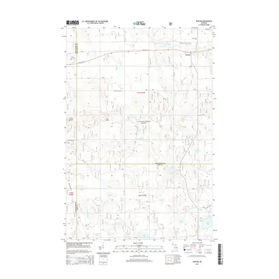
2014 Map of Kenton
USGS Topo · Published 2014About this map
Kenton serves as the primary settlement in this section of the Ottawa National Forest, where the Upper Peninsula’s complex hydrology defines the landscape. The East Branch Ontonagon River and the Jumbo River carve through the terrain, the latter featuring multiple cascades including Jumbo Falls and Middle East Jumbo River Falls. This 2014 survey documents a region where three counties—Houghton, Ontonagon, and Iron—converge, marking a transitional space for land management and water drainage. Local family history is anchored at the Kenton Cem and Trout Creek Cem, while landmarks like The Bluff and Lake Twentyeight provide fixed points for navigation. The network of forest roads, including Golden Glow Rd W and Federal Forest 3630 Rd, illustrates the ongoing accessibility of this timber and recreation country.
Find a feature on this map
43 named features on this map. Tap any name to fly to it.
Don’t see what you’re looking for? This feature index may not catch every label — zoom into the map to look around manually.
Map Details
Editions of this 2014 Kenton Map
This is the sole edition of this map. No revisions or reprints were ever made.
Other maps of this area

1949 · Rockland
USGS Topo · 1:62,500

1951 · Rockland
USGS Topo · 1:62,500

1952 · Watersmeet
USGS Topo · 1:62,500

1954 · Rousseau
USGS Topo · 1:62,500

1954 · Kenton
USGS Topo · 1:62,500

1958 · Iron River
USGS Topo · 1:250,000

1960 · Iron River
USGS Topo · 1:250,000

1961 · Iron River
USGS Topo · 1:250,000

1967 · Iron River
USGS Topo · 1:250,000

1979 · Ontonagon
USGS Topo · 1:100,000