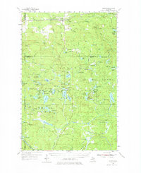
1954 Map of Kenton
USGS Topo · Published 1976About this map
Kenton serves as the primary hub of activity in this section of the western Upper Peninsula, situated along the line of the Duluth South Shore and Atlantic railroad. The landscape is defined by the heavy timber of the Ottawa National Forest, where a network of lookouts including Trout Creek Lookout Tower, Tepee Lookout Tower, and Mallard Lake Lookout Tower monitor the dense canopy. Water dominates the geography, from the winding Branch Ontonagon River to the many isolated lakes like Beitner Lake and Lake Thirteen. Local history is anchored by the presence of the Kenton Cem and Kitchie Cem, while industrial activity is noted at the local Quarry and various gravel pits. The terrain rises toward distinctive high points like Haystack Mountain and The Bluff, overlooking a remote region of the northern woods managed by the Michigan Department of Conservation.
Find a feature on this map
132 named features on this map. Tap any name to fly to it.
Don’t see what you’re looking for? This feature index may not catch every label — zoom into the map to look around manually.
Map Details
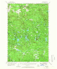
Editions of this 1954 Kenton Map

Other maps of this area

1895 · Perch Lake
USGS Topo · 1:62,500

1898 · Iron River
USGS Topo · 1:62,500

1938 · Phelps
USGS Topo · 1:48,000

1945 · Gibbs City
USGS Topo · 1:24,000

1946 · Gibbs City
USGS Topo · 1:31,680

1949 · Rockland
USGS Topo · 1:62,500

1950 · Phelps
USGS Topo · 1:48,000

1951 · Rockland
USGS Topo · 1:62,500

1952 · Watersmeet
USGS Topo · 1:62,500

1954 · Rousseau
USGS Topo · 1:62,500
Featured Places
- Iron River Township, MI
- Stambaugh Township, MI
- Duncan Township, MI
- Bates Township, MI
- Watersmeet Township, MI