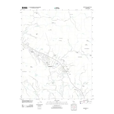
2012 Map of Kenwood
USGS Topo · Published 2012About this map
The viticultural landscape of the Sonoma Valley is defined here by a dense concentration of historic and modern estates, including Kenwood Winery, Kunde Winery, and Chateau Saint Jean Winery. In this 2012 USGS topo, the valley floor is dominated by the linear settlements of Lawndale and Kenwood, which follow the course of Sonoma Creek and the surrounding highways. The map illustrates a transition from the manicured grounds of the Oakmont Golf Course and Oakmont retirement community to the steep, undeveloped slopes of Mount Hood, Sugarloaf Ridge, and Bald Mountain.
Find a feature on this map
105 named features on this map. Tap any name to fly to it.
Don’t see what you’re looking for? This feature index may not catch every label — zoom into the map to look around manually.
Map Details
Editions of this 2012 Kenwood Map
This is the sole edition of this map. No revisions or reprints were ever made.
Other maps of this area

1902 · Napa
USGS Topo · 1:125,000

1916 · Santa Rosa
USGS Topo · 1:62,500

1927 · Calistoga
USGS Topo · 1:62,500

1942 · Sonoma
USGS Topo · 1:62,500

1942 · St. Helena
USGS Topo · 1:62,500

1943 · Calistoga
USGS Topo · 1:62,500

1944 · Santa Rosa
USGS Topo · 1:62,500

1945 · Calistoga
USGS Topo · 1:62,500

1945 · St. Helena
USGS Topo · 1:62,500

1947 · Santa Rosa
USGS Topo · 1:250,000