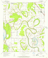
1954 Map of Keo
USGS Topo · Published 1957About this map
The Arkansas River corridor defines this mid-century landscape on the border of Lonoke and Pulaski counties, where a complex network of oxbow lakes and brakes reveals the river's historical shifts. A massive Levee system protects the agricultural lowlands, where small rural communities like Keo and Wampoo are linked by the St Louis Southwestern RR. The area is densely dotted with small country churches and family landmarks, including Millers Chapel, Macedonia Chapel, and Paradise Church, reflecting a deeply rooted rural society centered around cotton and river-bottom farming. Numerous distinct water bodies such as Mc Neely Brake, Morris Brake, and Clear Lake segment the terrain, while scattered Ruins and the Alexander Cemetery provide tangible points of interest for genealogists and local historians studying the early 1950s Arkansas Delta.
Find a feature on this map
40 named features on this map. Tap any name to fly to it.
Don’t see what you’re looking for? This feature index may not catch every label — zoom into the map to look around manually.
Map Details
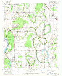
Editions of this 1954 Keo Map
2 editions found
Other maps of this area

1891 · Little Rock
USGS Topo · 1:125,000

1893 · Little Rock
USGS Topo · 1:125,000

1932 · Pastoria
USGS Topo · 1:62,500

1935 · Sweet Home
USGS Topo · 1:24,000

1935 · Altheimer
USGS Topo · 1:62,500

1935 · Pastoria
USGS Topo · 1:62,500

1937 · England
USGS Topo · 1:48,000

1939 · Keo
USGS Topo · 1:31,680

1940 · Woodson
USGS Topo · 1:31,680

1941 · Keo
USGS Topo · 1:31,680