
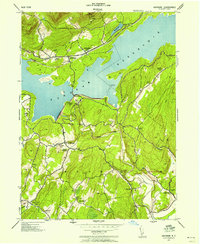
1942 Map of Kerhonkson
USGS Topo · Published 1959About this map
Kerhonkson and the Wawarsing area represent a vital corridor of transit and industry in Ulster County during the mid-twentieth century. The landscape is defined by the parallel courses of Rondout Creek, the New York Ontario and Western railroad, and the remnants of the Rondout and Western Canal. This concentration of infrastructure in the valley floor contrasts sharply with the upland settlements like Mombaccus, Tabasco, and Liebhardt that are scattered across the surrounding slopes.
Find a feature on this map
34 named features on this map. Tap any name to fly to it.
Don’t see what you’re looking for? This feature index may not catch every label — zoom into the map to look around manually.
Map Details
Editions of this 1942 Kerhonkson Map
This is the sole edition of this map. No revisions or reprints were ever made.
Other maps of this area

1901 · Rosendale
USGS Topo · 1:62,500

1903 · Newburg
USGS Topo · 1:62,500

1903 · Rosendale
USGS Topo · 1:62,500

1903 · Slide Mountain
USGS Topo · 1:62,500

1904 · Ellenville
USGS Topo · 1:62,500

1905 · Slide Mountain
USGS Topo · 1:62,500

1906 · Ellenville
USGS Topo · 1:62,500

1942 · West Shokan
USGS Topo · 1:24,000
1942 · Ashokan
USGS Topo · 1:24,000

1942 · Lackawack
USGS Topo · 1:24,000