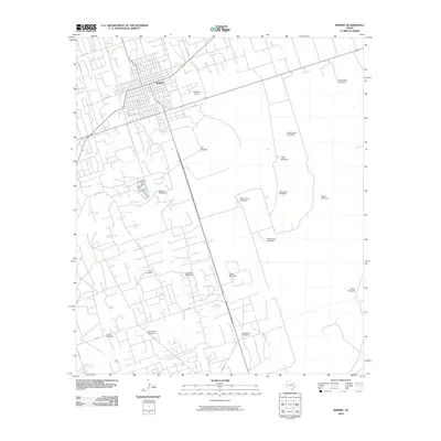
2010 Map of Kermit
USGS Topo · Published 2010About this map
Kermit serves as the hub of this West Texas landscape, where a dense street grid and the aviation facility at Robinson Airport anchor the local economy. The surrounding terrain is defined by a distinct pattern of water infrastructure, with numerous family-named and sectional landmarks such as Kermit Windmill, Two Section Windmill, and Wieseman Windmill indicating the vital importance of groundwater in this arid region. The map captures the transportation network of Winkler County in the early 21st century, showing the radial paths of FM 1232 and various county roads like Co RD 113 and Co RD 207 that connect the town to outlying pastoral sites. Significant features like South Sand Windmill and Hugh Windmill highlight the intersection of natural resources and private land management at the edge of the Chihuahuan Desert.
Find a feature on this map
30 named features on this map. Tap any name to fly to it.
Don’t see what you’re looking for? This feature index may not catch every label — zoom into the map to look around manually.
Map Details
Editions of this 2010 Kermit Map
This is the sole edition of this map. No revisions or reprints were ever made.
Other maps of this area

1954 · Pecos
USGS Topo · 1:250,000

1957 · Pecos
USGS Topo · 1:250,000

1968 · Wink South
USGS Topo · 1:24,000

1968 · China Ranch
USGS Topo · 1:24,000

1969 · Pyote NE
USGS Topo · 1:24,000

1970 · Wink North
USGS Topo · 1:24,000

1970 · Vesrue
USGS Topo · 1:24,000

1970 · Kermit NW
USGS Topo · 1:24,000

1970 · Kermit
USGS Topo · 1:24,000

1971 · Notrees NW
USGS Topo · 1:24,000