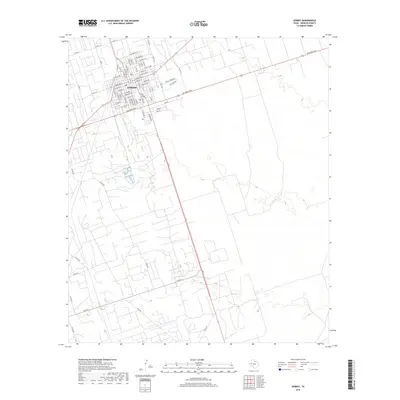
2019 Map of Kermit
USGS Topo · Published 2019About this map
Kermit serves as the focal point of this West Texas landscape, showing a dense residential and commercial grid that transitions abruptly into the expansive Permian Basin terrain. The town's layout is meticulously detailed, with a street plan including E San Angelo St, E Midland Ave, and E Tascosa Ave providing a clear picture of the local community structure. Beyond the central hub, the map reveals a complex network of county roads such as Co Rd 407 and Co Rd 313 that stretch across the arid plains, tracing the infrastructure required for the region's energy and ranching interests. The presence of Jim Sharp Blvd and Fm 1232 highlights the primary transportation corridors that connect this isolated settlement to the wider Winkler County area.
Find a feature on this map
74 named features on this map. Tap any name to fly to it.
Don’t see what you’re looking for? This feature index may not catch every label — zoom into the map to look around manually.
Map Details
Editions of this 2019 Kermit Map
This is the sole edition of this map. No revisions or reprints were ever made.
Other maps of this area

1954 · Pecos
USGS Topo · 1:250,000

1957 · Pecos
USGS Topo · 1:250,000

1968 · Wink South
USGS Topo · 1:24,000

1968 · China Ranch
USGS Topo · 1:24,000

1969 · Pyote NE
USGS Topo · 1:24,000

1970 · Wink North
USGS Topo · 1:24,000

1970 · Vesrue
USGS Topo · 1:24,000

1970 · Kermit NW
USGS Topo · 1:24,000

1970 · Kermit
USGS Topo · 1:24,000

1971 · Notrees NW
USGS Topo · 1:24,000