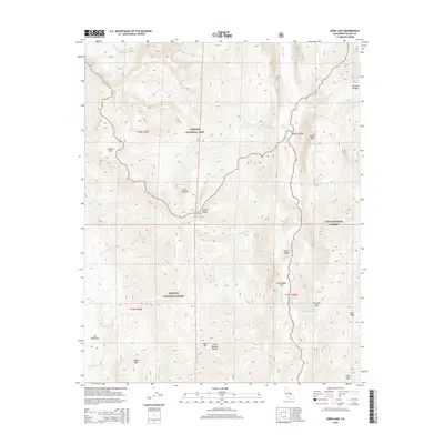
2015 Map of Kern Lake
USGS Topo · Published 2015About this map
The Kern River carves a deep path through the southern High Sierra, defining the center of this terrain where the Sequoia National Park, Sequoia National Forest, and Inyo National Forest converge. This survey documents the complex hydrological and geological features of the Upper Kern basin, including the distinctive Kern Lake and Little Kern Lake tucked within the Kern Canyon. High-altitude landmarks such as the Great Western Divide and the Sierra Nevada range dominate the western and central horizons, while the eastern edge is marked by steep formations like Tower Rock. The map illustrates a wilderness landscape shaped by water and granite, from the thermal interest of Soda Spring to the dramatic elevation changes at Hell for Sure and the isolated grazing grounds of Lion Meadows.
Find a feature on this map
40 named features on this map. Tap any name to fly to it.
Don’t see what you’re looking for? This feature index may not catch every label — zoom into the map to look around manually.
Map Details
Editions of this 2015 Kern Lake Map
This is the sole edition of this map. No revisions or reprints were ever made.
Other maps of this area

1904 · Kaweah
USGS Topo · 1:125,000

1905 · Olancha
USGS Topo · 1:125,000

1907 · Olancha
USGS Topo · 1:125,000

1909 · Kaweah
USGS Topo · 1:125,000

1937 · Kaweah
USGS Topo · 1:125,000

1948 · Fresno
USGS Topo · 1:250,000

1955 · Fresno
USGS Topo · 1:250,000

1956 · Fresno
USGS Topo · 1:250,000

1956 · Hockett Peak
USGS Topo · 1:62,500

1956 · Mineral King
USGS Topo · 1:62,500