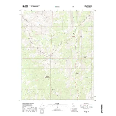
2018 Map of Kern Lake
USGS Topo · Published 2018About this map
Kern Canyon dominates this high-altitude landscape where the Kern River carves through the southern Sierra Nevada. The terrain is defined by the massive Great Western Divide and the Kern Ridge, which separate the high meadows and peaks of Sequoia National Park from the surrounding Sequoia National Forest and Inyo National Forest. High-country water features are prominent, including Kern Lake, Little Kern Lake, and the remote Coyote Lakes. The map documents a strictly wilderness environment, evidenced by the absence of roads and the presence of named backcountry landmarks like Lion Meadows and Grasshopper Flat. Steep granite formations such as Tower Rock and Angora Mtn rise above the drainage systems of Coyote Cr and Golden Trout Cr, the latter of which features the aptly named Volcano Falls. This survey serves as a definitive record of the trails and natural topography within these protected federal lands.
Find a feature on this map
41 named features on this map. Tap any name to fly to it.
Don’t see what you’re looking for? This feature index may not catch every label — zoom into the map to look around manually.
Map Details
Editions of this 2018 Kern Lake Map
This is the sole edition of this map. No revisions or reprints were ever made.
Other maps of this area

1904 · Kaweah
USGS Topo · 1:125,000

1905 · Olancha
USGS Topo · 1:125,000

1907 · Olancha
USGS Topo · 1:125,000

1909 · Kaweah
USGS Topo · 1:125,000

1937 · Kaweah
USGS Topo · 1:125,000

1948 · Fresno
USGS Topo · 1:250,000

1955 · Fresno
USGS Topo · 1:250,000

1956 · Fresno
USGS Topo · 1:250,000

1956 · Hockett Peak
USGS Topo · 1:62,500

1956 · Mineral King
USGS Topo · 1:62,500