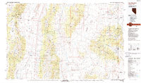
1988 Map of Kern Mountains
USGS Topo · Published 1988About this map
Schellbourne and Cherry Creek Station anchor this high-desert landscape in White Pine County, where the Great Basin's basin-and-range geography is strikingly evident. The map tracks a series of north-south corridors, including the Steptoe Valley and Spring Valley, separated by the formidable elevations of the Schell Creek Range and the Egan Range. This 1980s data highlights the land management patterns of the era, showing the extensive Humboldt National Forest and the Goshute Indian Reservation straddling the Nevada-Utah border. Water sources like Monte Neva Hot Springs and scattered wells such as South Butte Well indicate the critical role of sparse hydrologic features in this arid environment. Significant mountain passes, including Schellbourne Pass and Tippett Pass, reveal the historical transit routes used to navigate the rugged interior.
Find a feature on this map
69 named features on this map. Tap any name to fly to it.
Don’t see what you’re looking for? This feature index may not catch every label — zoom into the map to look around manually.
Map Details
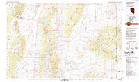
Editions of this 1988 Kern Mountains Map
2 editions found
Other maps of this area

1908 · Fish Springs
USGS Topo · 1:250,000

1910 · Fish Springs
USGS Topo · 1:250,000

1925 · Gold Hill
USGS Topo · 1:62,500

1928 · Gold Hill
USGS Topo · 1:62,500

1952 · Ely
USGS Topo · 1:125,000

1953 · Tooele
USGS Topo · 1:250,000

1953 · Delta
USGS Topo · 1:250,000

1955 · Tooele
USGS Topo · 1:250,000

1955 · Elko
USGS Topo · 1:250,000

1956 · Ely
USGS Topo · 1:250,000