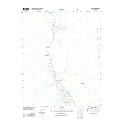
2012 Map of Kernville
USGS Topo · Published 2012About this map
The Kern River carves a deep path through this Sierra Nevada landscape, serving as the central artery for a string of riverside camps and recreational sites near the town of Kernville. In the southern portion of the sheet, the community of Riverkern is nestled between the riverbanks and the rising slopes of Powers Peak. The map reveals a high concentration of seasonal and administrative hubs, including the Cannell Meadow District Ranger Office and the Camp Owens facility, which underscore the area's role as a primary gateway for mountain access.
Find a feature on this map
32 named features on this map. Tap any name to fly to it.
Don’t see what you’re looking for? This feature index may not catch every label — zoom into the map to look around manually.
Map Details
Editions of this 2012 Kernville Map
This is the sole edition of this map. No revisions or reprints were ever made.
Other maps of this area

1905 · Fairview
USGS Topo · 1:24,000

1906 · Kernville
USGS Topo · 1:125,000

1908 · Kernville
USGS Topo · 1:125,000

1918 · Fairview
USGS Topo · 1:31,680

1920 · Delonagha
USGS Topo · 1:62,500

1926 · Glennville
USGS Topo · 1:62,500

1936 · Tobias Peak
USGS Topo · 1:125,000

1943 · Tobias Peak
USGS Topo · 1:125,000

1943 · Isabella
USGS Topo · 1:62,500

1945 · Tobias Peak
USGS Topo · 1:62,500