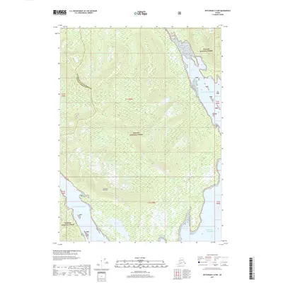
2017 Map of Ketchikan C-6 NW
USGS Topo · Published 2017About this map
Cleveland Peninsula dominates this coastal landscape where the wild terrain of the Tongass National Forest meets the saltwater inlets of the Gulf of Alaska. The map illustrates a complex network of waterways and timbered ridges, defined by deep indentations like Port Stewart to the north and the expansive Helm Bay at the southern edge. The boundary between the Ketchikan Gateway Borough and Wrangell Borough cuts across the northwest corner, marking an administrative division in this largely roadless area. Interior water features such as Helm Lake and the drainage of Granite Creek reveal the hydrological patterns of the peninsula, while coastal landmarks like Raymond Cove and Forss Island provide essential points of reference for maritime navigation and local history along these remote shorelines.
Find a feature on this map
17 named features on this map. Tap any name to fly to it.
Don’t see what you’re looking for? This feature index may not catch every label — zoom into the map to look around manually.
Map Details
Editions of this 2017 Ketchikan C-6 NW Map
This is the sole edition of this map. No revisions or reprints were ever made.
Other maps of this area

1949 · Ketchikan C-6
USGS Topo · 1:63,360

1949 · Craig D-1
USGS Topo · 1:63,360

1950 · Craig C-1
USGS Topo · 1:63,360

1951 · Craig C-1
USGS Topo · 1:63,360

1951 · Craig D-1
USGS Topo · 1:63,360

1952 · Ketchikan
USGS Topo · 1:250,000

1952 · Ketchikan C-6
USGS Topo · 1:63,360

1952 · Ketchikan D-6
USGS Topo · 1:63,360

1953 · Ketchikan D-6
USGS Topo · 1:63,360

1955 · Ketchikan
USGS Topo · 1:250,000