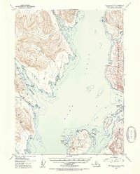
1952 Map of Ketchikan C-6
USGS Topo · Published 1954About this map
Revillagigedo Island and the western reaches of the Tongass National Forest dominate this early 1950s survey of the Alaskan coast. The map illustrates a landscape defined by maritime industry and remote resource extraction, particularly around Helm Bay where several mining operations are documented. At this time, the Old Standard Mine was noted as inactive, while the Alaska Gold Mtn Mines and Steers Mine remained prominent landmarks for those navigating the waters near Gold Mtn.
Find a feature on this map
50 named features on this map. Tap any name to fly to it.
Don’t see what you’re looking for? This feature index may not catch every label — zoom into the map to look around manually.
Map Details
Editions of this 1952 Ketchikan C-6 Map
2 editions found
Other maps of this area

1948 · Ketchikan C-5
USGS Topo · 1:63,360

1949 · Ketchikan C-6
USGS Topo · 1:63,360

1949 · Craig B-1
USGS Topo · 1:63,360

1949 · Craig D-1
USGS Topo · 1:63,360

1950 · Craig B-1
USGS Topo · 1:63,360

1950 · Craig C-1
USGS Topo · 1:63,360

1951 · Craig C-1
USGS Topo · 1:63,360

1951 · Craig D-1
USGS Topo · 1:63,360

1952 · Ketchikan
USGS Topo · 1:250,000

1952 · Ketchikan C-6
USGS Topo · 1:63,360