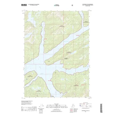
2017 Map of Ketchikan D-5 NW
USGS Topo · Published 2017About this map
Bell Island Hot Springs sits at the heart of this coastal wilderness, located along the northern shore of Bell Island within the expansive Tongass National Forest. The landscape is defined by deep marine channels and protected passages, including the Behm Canal and Behm Narrows, which separate high-elevation coastal mountains from the fractured island system. Water dominates the interior terrain as well, with significant bodies such as Lake Shelokum in the north and Lake Maude to the west, situated in deep glacial basins.
Find a feature on this map
26 named features on this map. Tap any name to fly to it.
Don’t see what you’re looking for? This feature index may not catch every label — zoom into the map to look around manually.
Map Details
Editions of this 2017 Ketchikan D-5 NW Map
This is the sole edition of this map. No revisions or reprints were ever made.
Other maps of this area

1951 · Bradfield Canal
USGS Topo · 1:250,000

1952 · Ketchikan
USGS Topo · 1:250,000

1952 · Ketchikan D-5
USGS Topo · 1:63,360

1952 · Ketchikan D-6
USGS Topo · 1:63,360

1953 · Ketchikan D-5
USGS Topo · 1:63,360

1953 · Ketchikan D-6
USGS Topo · 1:63,360

1954 · Bradfield Canal
USGS Topo · 1:250,000

1955 · Bradfield canal A-6
USGS Topo · 1:63,360

1955 · Bradfield Canal A-5
USGS Topo · 1:63,360

1955 · Ketchikan
USGS Topo · 1:250,000