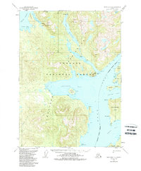
1952 Map of Ketchikan D-6
USGS Topo · Published 1988About this map
Lake McDonald and the surrounding wilderness of the Tongass National Forest define this coastal landscape as it was documented in the mid-20th century. The intricate shoreline of the Cleveland Peninsula reveals a maritime economy and infrastructure dependent on deep-water inlets, including the Fish Hatchery near the head of Yes Bay. These protected waters provided essential shelter and resources for early coastal development in Southeast Alaska, with navigation aided by the Lighthouse Reserve at Bluff Point. Across the Behm Canal, the western edge of Revillagigedo Island rises sharply, marked by local landmarks like Brow Point and Nose Point. The map provides a detailed view of the natural hydrology of the region, from the high elevations of Table Mountain and the Twin Rift down to the salmon-bearing waters of Wasta Creek and Walker Cr.
Find a feature on this map
39 named features on this map. Tap any name to fly to it.
Don’t see what you’re looking for? This feature index may not catch every label — zoom into the map to look around manually.
Map Details
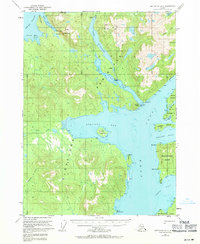
Editions of this 1952 Ketchikan D-6 Map
3 editions found

Other maps of this area

1948 · Petersburg A-1
USGS Topo · 1:63,360

1948 · Ketchikan C-5
USGS Topo · 1:63,360

1949 · Ketchikan C-6
USGS Topo · 1:63,360

1949 · Craig D-1
USGS Topo · 1:63,360

1950 · Craig C-1
USGS Topo · 1:63,360

1951 · Bradfield Canal
USGS Topo · 1:250,000

1951 · Craig C-1
USGS Topo · 1:63,360

1951 · Craig D-1
USGS Topo · 1:63,360

1951 · Petersburg A-1
USGS Topo · 1:63,360

1952 · Petersburg
USGS Topo · 1:250,000