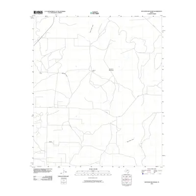
2010 Map of Ketchum Mountain
USGS Topo · Published 2010About this map
Ketchum Mountain stands as the central landmark in this portion of Irion County, where the high-plains landscape is defined by its seasonal drainage patterns and ranching heritage. The terrain is marked by significant watercourses including South Liveoak Draw, McDowell Draw, and Big Hollow Draw, which illustrate the natural watershed of the region. The presence of the Ketchum Oil Field in the southwest indicates the continued importance of the energy industry in the local economy during the early 21st century.
Find a feature on this map
9 named features on this map. Tap any name to fly to it.
Don’t see what you’re looking for? This feature index may not catch every label — zoom into the map to look around manually.
Map Details
Editions of this 2010 Ketchum Mountain Map
This is the sole edition of this map. No revisions or reprints were ever made.
Other maps of this area

1895 · Sherwood
USGS Topo · 1:125,000

1920 · Barnhart
USGS Topo · 1:62,500

1921 · Ketchum Mountain
USGS Topo · 1:62,500

1922 · Barnhart
USGS Topo · 1:62,500

1923 · Ketchum Mountain
USGS Topo · 1:62,500

1954 · San Angelo
USGS Topo · 1:250,000

1958 · San Angelo
USGS Topo · 1:250,000

1965 · San Angelo
USGS Topo · 1:250,000

1971 · Noelke
USGS Topo · 1:24,000
1971 · Barnhart
USGS Topo · 1:24,000