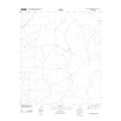
2012 Map of Ketchum Mountain
USGS Topo · Published 2012About this map
The high plateau country of Irion and Texas Counties is defined by its expansive ranching operations and energy production as it appeared in the early 2010s. Large-scale landholdings such as Magruder Ranch and Cox Ranch dominate the landscape, reflecting the region's enduring agricultural heritage. A network of private and ranch-access roads, including Cal Suggs Rd and Ketchum Mt Rd, provides the primary means of navigating this arid terrain. The map highlights the intersection of natural topography and industry, with Ketchum Mtn standing as a prominent landmark near the sprawling Ketchum Oil Field. This area demonstrates the typical West Texas land-use pattern where traditional cattle ranching and modern petroleum extraction coexist across a landscape of dry draws and mesas.
Find a feature on this map
10 named features on this map. Tap any name to fly to it.
Don’t see what you’re looking for? This feature index may not catch every label — zoom into the map to look around manually.
Map Details
Editions of this 2012 Ketchum Mountain Map
This is the sole edition of this map. No revisions or reprints were ever made.
Other maps of this area

1895 · Sherwood
USGS Topo · 1:125,000

1920 · Barnhart
USGS Topo · 1:62,500

1921 · Ketchum Mountain
USGS Topo · 1:62,500

1922 · Barnhart
USGS Topo · 1:62,500

1923 · Ketchum Mountain
USGS Topo · 1:62,500

1954 · San Angelo
USGS Topo · 1:250,000

1958 · San Angelo
USGS Topo · 1:250,000

1965 · San Angelo
USGS Topo · 1:250,000

1971 · Noelke
USGS Topo · 1:24,000
1971 · Barnhart
USGS Topo · 1:24,000