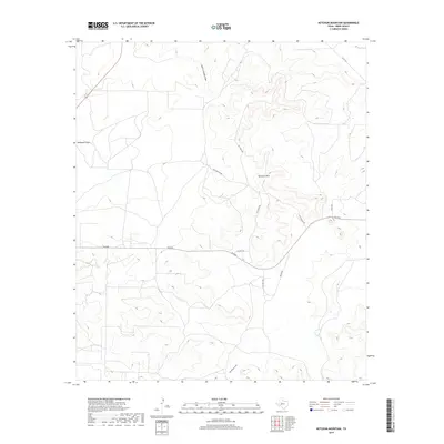
2019 Map of Ketchum Mountain
USGS Topo · Published 2019About this map
Ketchum Mtn rises as a central landform in this West Texas survey of Irion County, overseeing a landscape defined by its network of drainage draws and ranch-to-market infrastructure. The terrain is etched by seasonal watercourses including South Liveoak Draw to the north and the extensive Big Hollow Draw at the southern border. The road network reflects a land of large ranching properties, named for local families and landmarks, such as Cal Suggs Rd, Jay Scott Rd, and Ketchum Mt Rd. This 2019 survey documents the modern layout of rural Texas transportation, where primary routes like FM 2469 intersect with specialized paths like N Plant Rd and Old House Rd, providing a clear record of land division and access in the high plains region.
Find a feature on this map
13 named features on this map. Tap any name to fly to it.
Don’t see what you’re looking for? This feature index may not catch every label — zoom into the map to look around manually.
Map Details
Editions of this 2019 Ketchum Mountain Map
This is the sole edition of this map. No revisions or reprints were ever made.
Other maps of this area

1895 · Sherwood
USGS Topo · 1:125,000

1920 · Barnhart
USGS Topo · 1:62,500

1921 · Ketchum Mountain
USGS Topo · 1:62,500

1922 · Barnhart
USGS Topo · 1:62,500

1923 · Ketchum Mountain
USGS Topo · 1:62,500

1954 · San Angelo
USGS Topo · 1:250,000

1958 · San Angelo
USGS Topo · 1:250,000

1965 · San Angelo
USGS Topo · 1:250,000

1971 · Noelke
USGS Topo · 1:24,000
1971 · Barnhart
USGS Topo · 1:24,000