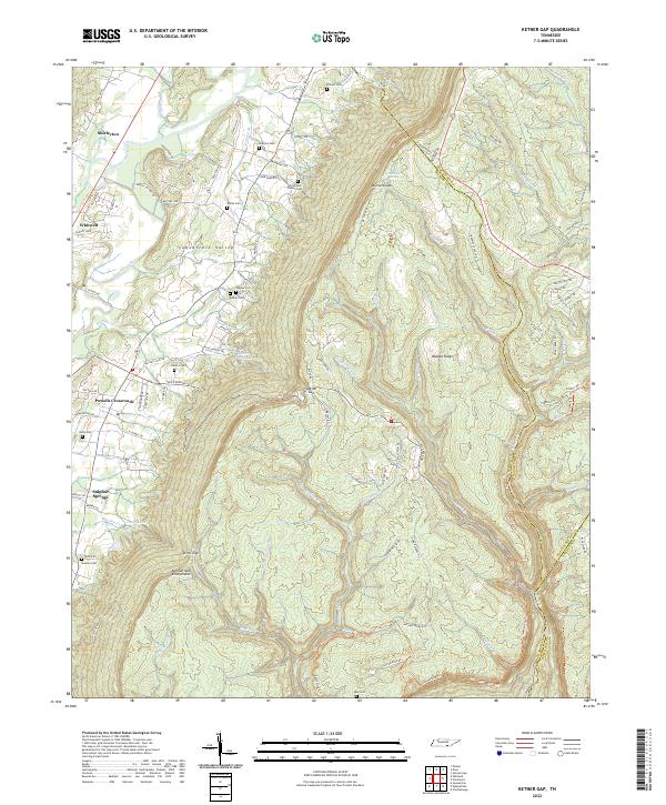
2022 Map of Ketner Gap
USGS Topo · Published 2022About this map
Walden Ridge and the Cumberland Escarpment dominate the landscape of this southern Tennessee terrain, where the high plateau drops sharply into the Sequatchie Valley. This transition is most clearly seen at Ketner Gap, a significant notch in the ridge that has long served as a natural passage for travel between the valley and the heights above. The Sequatchie River meanders through the western lowlands, supporting a string of settlements including Whitwell, Powells Crossroads, and Shirleyton.
Find a feature on this map
106 named features on this map. Tap any name to fly to it.
Don’t see what you’re looking for? This feature index may not catch every label — zoom into the map to look around manually.
Map Details
Editions of this 2022 Ketner Gap Map
This is the sole edition of this map. No revisions or reprints were ever made.
Other maps of this area

1888 · Chattanooga
USGS Topo · 1:125,000

1893 · Chattanooga
USGS Topo · 1:125,000

1895 · Sewanee
USGS Topo · 1:125,000

1936 · Palmer
USGS Topo · 1:24,000

1936 · Daus
USGS Topo · 1:24,000

1936 · Henson Gap
USGS Topo · 1:24,000

1936 · Whitwell
USGS Topo · 1:24,000

1936 · Ketner Gap
USGS Topo · 1:24,000

1936 · Fairmount
USGS Topo · 1:24,000

1936 · Wauhatchie
USGS Topo · 1:24,000
Featured Places
- Signal Mountain, TN
- Whitwell, TN
- Powells Crossroads, TN
- Shirleyton, TN
- Sulphur Springs, Powells Crossroads