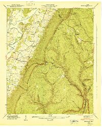
1946 Map of Ketner Gap
USGS Topo · Published 1947About this map
Cumberland Escarpment looms over the eastern side of the Sequatchie Valley in this mid-century topographic survey. The valley floor is defined by a dense network of family-named landmarks and rural institutions, including the Hicks Chapel Sch and Sulphur Springs Sch. Small settlements like Powells Crossroads and Shirleyton serve as local hubs along the Alvin York Highway, while the St Louis and Nashville Chattanooga Railroad follows the Sequatchie River through the lowlands.
Find a feature on this map
54 named features on this map. Tap any name to fly to it.
Don’t see what you’re looking for? This feature index may not catch every label — zoom into the map to look around manually.
Map Details
Editions of this 1946 Ketner Gap Map
This is the sole edition of this map. No revisions or reprints were ever made.
Other maps of this area

1888 · Chattanooga
USGS Topo · 1:125,000

1893 · Chattanooga
USGS Topo · 1:125,000

1895 · Sewanee
USGS Topo · 1:125,000

1936 · Palmer
USGS Topo · 1:24,000

1936 · Daus
USGS Topo · 1:24,000

1936 · Henson Gap
USGS Topo · 1:24,000

1936 · Whitwell
USGS Topo · 1:24,000

1936 · Ketner Gap
USGS Topo · 1:24,000

1936 · Fairmount
USGS Topo · 1:24,000

1936 · Wauhatchie
USGS Topo · 1:24,000
Featured Places
- Signal Mountain, TN
- Whitwell, TN
- Powells Crossroads, TN
- Shirleyton, TN
- Sulphur Springs, Powells Crossroads