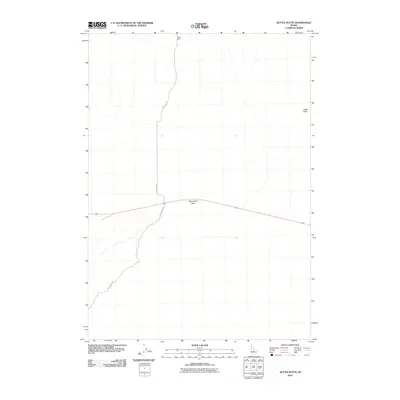
2010 Map of Kettle Butte
USGS Topo · Published 2010About this map
Twentymile Rock and Kettle Butte dominate this high desert landscape in Bonneville County, providing critical landmarks in a vast expanse of lava fields and sagebrush. This 2010 survey illustrates the remote road network that services this corner of Idaho, including the intersection of Mud Lake Rd and 20 Mile Rock Rd. Grounded in the necessities of the arid West, Taylor Well stands as one of the few named utility features in the quadrangle. The map is a study of isolation and open-country navigation, where volcanic formations and singular water sources dictate the movement of travelers and ranchers across the high plateau north of the Snake River Plain.
Find a feature on this map
5 named features on this map. Tap any name to fly to it.
Don’t see what you’re looking for? This feature index may not catch every label — zoom into the map to look around manually.
Map Details
Editions of this 2010 Kettle Butte Map
This is the sole edition of this map. No revisions or reprints were ever made.
Other maps of this area

1955 · Idaho Falls
USGS Topo · 1:250,000

1958 · Idaho Falls
USGS Topo · 1:250,000

1964 · Kettle Butte NE
USGS Topo · 1:24,000

1964 · Kettle Butte NW
USGS Topo · 1:24,000

1964 · Kettle Butte SW
USGS Topo · 1:24,000
1964 · Morgans Pasture NE
USGS Topo · 1:24,000
1964 · Butterfly Butte
USGS Topo · 1:24,000

1973 · Little Butte NE
USGS Topo · 1:24,000

1973 · Little Butte
USGS Topo · 1:24,000

1973 · Taber NE
USGS Topo · 1:24,000