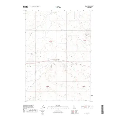
2020 Map of Kettle Butte
USGS Topo · Published 2020About this map
Kettle Butte and the distinctive geological formation of Twentymile Rock dominate this section of Bonneville County, illustrating the high-desert volcanic topography of the Snake River Plain. This 2020 survey details the complex public land survey system across Township 2 and 3 North, covering Ranges 34 and 35 East. The landscape is defined by its subtle elevation shifts and sparse naming, characteristic of this remote portion of Idaho. Topographic contours at 10-foot intervals trace the volcanic features and the transition between t3n r34e, t3n r35e, t2n r34e, and t2n r35e. The map reflects a modern inventory of the area's physical geography and jurisdictional boundaries, emphasizing the preservation of specific landmarks like the butte within an otherwise expansive open terrain.
Find a feature on this map
6 named features on this map. Tap any name to fly to it.
Don’t see what you’re looking for? This feature index may not catch every label — zoom into the map to look around manually.
Map Details
Editions of this 2020 Kettle Butte Map
This is the sole edition of this map. No revisions or reprints were ever made.
Other maps of this area

1955 · Idaho Falls
USGS Topo · 1:250,000

1958 · Idaho Falls
USGS Topo · 1:250,000

1964 · Kettle Butte NE
USGS Topo · 1:24,000

1964 · Kettle Butte NW
USGS Topo · 1:24,000

1964 · Kettle Butte SW
USGS Topo · 1:24,000
1964 · Morgans Pasture NE
USGS Topo · 1:24,000
1964 · Butterfly Butte
USGS Topo · 1:24,000

1973 · Little Butte NE
USGS Topo · 1:24,000

1973 · Little Butte
USGS Topo · 1:24,000

1973 · Taber NE
USGS Topo · 1:24,000