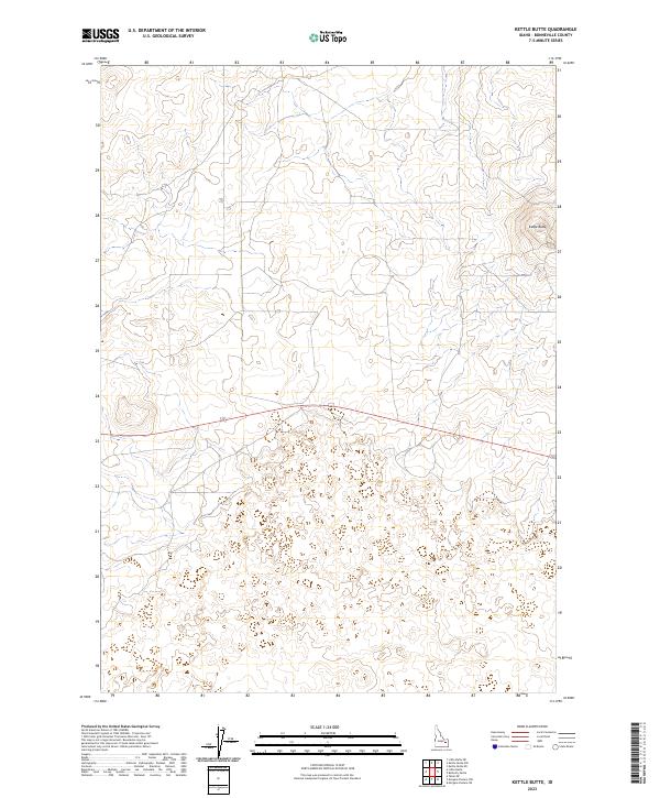
2023 Map of Kettle Butte
USGS Topo · Published 2023About this map
Kettle Butte dominates the eastern edge of this section of Bonneville County, rising above a landscape defined by volcanic landforms and high desert terrain. The topography here is relatively sparse, characterized by low volcanic mounds and depressions typical of the Eastern Snake River Plain. This 2023 survey identifies the intersection of four townships—t3n r34e, t3n r35e, t2n r34e, and t2n r35e—showing how modern cartography continues to track the established Public Land Survey System. A single local connector road cuts across the center of the sheet, providing the primary access through this open country, which remains largely free of major structures or named settlements, reflecting the enduring rural and undeveloped nature of this corner of Idaho.
Find a feature on this map
5 named features on this map. Tap any name to fly to it.
Don’t see what you’re looking for? This feature index may not catch every label — zoom into the map to look around manually.
Map Details
Editions of this 2023 Kettle Butte Map
This is the sole edition of this map. No revisions or reprints were ever made.
Other maps of this area

1955 · Idaho Falls
USGS Topo · 1:250,000

1958 · Idaho Falls
USGS Topo · 1:250,000

1964 · Kettle Butte NE
USGS Topo · 1:24,000

1964 · Kettle Butte NW
USGS Topo · 1:24,000

1964 · Kettle Butte SW
USGS Topo · 1:24,000
1964 · Morgans Pasture NE
USGS Topo · 1:24,000
1964 · Butterfly Butte
USGS Topo · 1:24,000

1973 · Little Butte NE
USGS Topo · 1:24,000

1973 · Little Butte
USGS Topo · 1:24,000

1973 · Taber NE
USGS Topo · 1:24,000