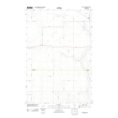
2013 Map of Kettle River
USGS Topo · Published 2013About this map
Kettle River serves as the primary settlement hub on this northern Minnesota landscape, situated at the junction of MN-73 and Co HWY-12. The terrain is defined by a dense drainage network where the Dead Moose River and Silver Cr feed into the larger Kettle River system. For those researching local family histories, the map identifies significant sites such as Saint Joseph's Cem and Nordland Cem, which anchor the rural community. The geography transitions across the Carlton Co and Pine Co line, showing a pattern of long-established farmsteads and rural roads like Butkiewicz Rd and Korhonen Rd. The meandering course of the Split Rock River cuts through the central portion of the quadrangle, illustrating the complex water table of this Northwoods region.
Find a feature on this map
35 named features on this map. Tap any name to fly to it.
Don’t see what you’re looking for? This feature index may not catch every label — zoom into the map to look around manually.
Map Details
Editions of this 2013 Kettle River Map
This is the sole edition of this map. No revisions or reprints were ever made.
Other maps of this area

1953 · Duluth
USGS Topo · 1:250,000

1958 · Duluth
USGS Topo · 1:250,000

1961 · Cromwell
USGS Topo · 1:62,500

1961 · Moose Lake
USGS Topo · 1:62,500

1969 · Arthyde
USGS Topo · 1:24,000

1969 · Ronald
USGS Topo · 1:24,000

1969 · Automba
USGS Topo · 1:24,000

1980 · Sandstone
USGS Topo · 1:100,000

1980 · Duluth
USGS Topo · 1:100,000

1981 · Willow River
USGS Topo · 1:24,000
Featured Places
- Kettle River, MN
- Split Rock Township, MN
- Birch Creek Township, MN
- Sturgeon Lake Township, MN
- Silver Township, MN