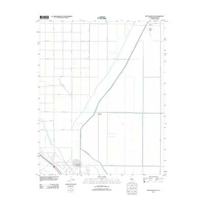
2012 Map of Kettleman City
USGS Topo · Published 2012About this map
Kettleman City serves as the primary hub in this corner of the San Joaquin Valley, where the local street grid including Milham St and King St meets the massive infrastructure of the California water system. The landscape is defined by its industrial-scale agriculture and water management, dominated by the sweeping curve of the Governor Edmund G Brown California Aqueduct and the diagonal course of the Blakeley Canal. North of the town center, the geography transitions into a strictly partitioned grid of agricultural avenues, from Quincy Ave to Newton Ave, supporting operations like the West Tulare Lands Ranch and West Lake Farms. This survey captures the region's total reliance on engineered irrigation, with the Po located in the heart of the settlement to serve the local ranching and farming community.
Find a feature on this map
26 named features on this map. Tap any name to fly to it.
Don’t see what you’re looking for? This feature index may not catch every label — zoom into the map to look around manually.
Map Details
Editions of this 2012 Kettleman City Map
This is the sole edition of this map. No revisions or reprints were ever made.
Other maps of this area

1912 · Coalinga
USGS Topo · 1:125,000

1914 · Lost Hills
USGS Topo · 1:125,000

1914 · Cholame
USGS Topo · 1:125,000

1915 · Cholame
USGS Topo · 1:125,000

1917 · Cholame
USGS Topo · 1:125,000

1929 · Stratford
USGS Topo · 1:31,680

1929 · Westhaven
USGS Topo · 1:31,680

1930 · Discovery Well
USGS Topo · 1:31,680

1930 · Kettleman Plain
USGS Topo · 1:31,680

1930 · Middle Dome
USGS Topo · 1:31,680