Old Maps of Westlake Farms, California
Explore 18 old maps of Westlake Farms, spanning from 1933 to today. These high-resolution historic maps reveal how streets, neighborhoods, landmarks, and natural features evolved over time — perfect for genealogy, metal detecting, research, and local history exploration.
What you can do with these maps:
- See how Westlake Farms changed over time: Compare historical maps to modern-day views to trace roads, homesites, rail lines & more.
- View detailed metadata: Each map includes creators, publishers, year, scale, and archive source.
- Overlay maps with satellite & LiDAR: Visualize the past alongside modern tools to explore terrain & human change.
- Trusted historical sources: Maps sourced from the USGS, Library of Congress, and other archives.
- Access maps your way: View online, download high-res files, or order prints for personal or research use.
Start exploring old maps of Westlake Farms to uncover forgotten places, hidden landmarks, and the deep history beneath your feet.
Westlake Farms, CA maps
(18)- 1933 Map of Kettleman City
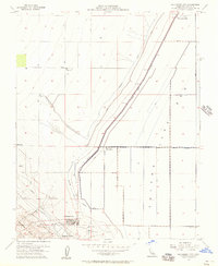
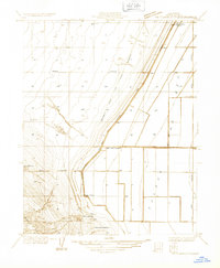 1933 Kettleman City1933 Print · USGSKings County in the early 1930s is a landscape of emergent oil fields and vast agricultural tracts at the edge of the Tulare Lake Bed. Researchers can trace the early layout of Kettleman City, early oil well sites in the Kettleman Hills, and family-named landmarks like Blakeley Ranch.
 - 1937 Map of Kettleman City
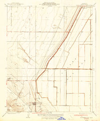 1937 Kettleman City1937 Print · USGSKings County agricultural life in the late 1930s is defined here by the rise of irrigation and large ranching estates. You can trace early settlement patterns and water infrastructure through the Blakeley Canal, Milham City, and the historic Goodfellow Ranch.3 unique versions available
 - 1940 Map of Stratford, 1954 Print
 1940 Stratford1954 Print · USGSThe reclaimed basin of the San Joaquin Valley comes into focus just before the mid-century, showing a landscape defined by industrial-scale irrigation and oil. Genealogists can locate family raches and rural schools like Ramona Sch, while tracing the early footprints of Stratford and Kettleman City.
 - 1943 Map of Stratford
 1943 Stratford1943 Print · USGSMid-century Kings County reveals a landscape of massive water engineering projects and valley farming as the Second World War began. Researchers can trace irrigation networks from Tulare Lake, find early school sites like Ramona Sch, and locate the Pacific Southern rail stops at Westhaven Station.
 - 1948 Map of Fresno
 1948 Fresno1948 Print · USGSThe San Joaquin Valley and the High Sierra met during a period of rapid post-war growth and industrial expansion. Genealogists and researchers can trace family lines through small rail towns like Calwa City, find early aviation sites at Fresno-Chandler, or locate the Fresno Copper Mine.
 - 1954 Map of Kettleman City, 1957 Print
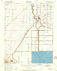
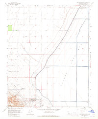
 1954 Kettleman City1957 Print · USGSKings County at the height of the post-war agricultural boom reveals a landscape of industrial farming and oil infrastructure. Researchers can trace the layout of Kettleman City, the vast Tulare Lake Bed, and sites like the Kettleman Hills Compressor Station and West Lake Farms.
 - 1955 Map of Fresno
 1955 Fresno1955 Print · USGSThe Central Valley and High Sierra meet in this mid-fifties study of California’s agricultural and wilderness heart. Researchers can trace the rail-side growth of Sanger, Selma, and Reedley or locate high-altitude landmarks like Mt Whitney and Hume Lake.
 - 1956 Map of Fresno
 1956 Fresno1956 Print · USGSThe Central Valley and High Sierra meet in this mid-fifties survey of a rapidly developing California interior. Researchers can trace the rail-and-water networks of Visalia, the footprint of Tulare Lake, and the remote heights of Sequoia National Park.
 - 1958 Map of Fresno
 1958 Fresno1958 Print · USGSThe Central Valley and High Sierra meet in this mid-century survey of the California heartland. Researchers can trace the rail-and-road network connecting Fresno and Visalia or locate high-country landmarks like Mt Whitney and Sequoia National Park.
 - 1960 Map of Fresno
 1960 Fresno1960 Print · USGSThe San Joaquin Valley's mid-century agricultural boom meets the high peaks of the Sierra Nevada in this detailed survey. Genealogists and historians can trace the rail-driven growth of Fresno, Tulare, and Visalia or locate family roots in smaller towns like Raisin City and Calwa City.2 unique versions available
 - 1962 Map of Fresno, 1968 Print
 1962 Fresno1968 Print · USGSThe Central Valley and High Sierra meet in this mid-century survey, capturing the region's massive irrigation systems and mountain wilderness. Researchers can trace the rail corridors of the Southern Pacific and locate landmarks like the Tulare Lake Bed and Mount Whitney.3 unique versions available
 - 1963 Map of Kettleman City, 1965 Print
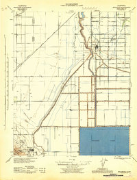
 1963 Kettleman City1965 Print · USGSKettleman City and the edge of the Kettleman Hills are captured here in the early 1960s, showing a landscape defined by water engineering. Researchers can trace infrastructure like the Blakeley Canal and industrial sites such as the Compressor Station.4 unique versions available
 - 1966 Map of Fresno
 1966 Fresno1966 Print · USGSCentral California in the mid-1960s showcases a high-production agricultural valley rising into the granite peaks of the High Sierra. Researchers can trace irrigation networks, rail spurs like the Southern Pacific, and landmarks from Mount Whitney to the Lemoore Naval Air Station.
 - 1993 Map of Visalia
 1993 Visalia1993 Print · USGSThe San Joaquin Valley comes alive in the early nineties, showing a landscape defined by the Tulare Lake Bed and its vast network of canals. Trace family roots and local history near Santa Rosa Rancheria, Pixley Nat Wildlife Ref, and the Tulare Co Fairgrounds.2 unique versions available
 - 2012 Map of Kettleman City, 2012 Print
 2012 Kettleman City2012 Print · USGSCovers Westlake Farms, including Kettleman City, Kings County, and other nearby areas
 - 2015 Map of Kettleman City, 2015 Print
 2015 Kettleman City2015 Print · USGSCovers Westlake Farms, including Kettleman City, Kings County, and other nearby areas
 - 2018 Map of Kettleman City, 2018 Print
 2018 Kettleman City2018 Print · USGSCovers Westlake Farms, including Kettleman City, Kings County, and other nearby areas
 - 2021 Map of Kettleman City, 2021 Print
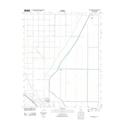
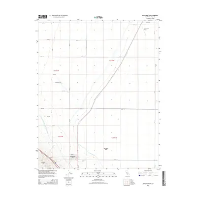
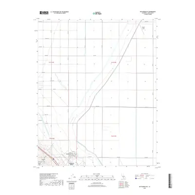
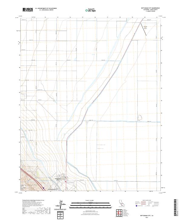 2021 Kettleman City2021 Print · USGSIn the heart of the San Joaquin Valley during the early 2020s, this area shows the intersection of intensive agriculture and major water infrastructure. Researchers can trace the grid of Kettleman City, the industrial footprint of Kettleman Station, and the path of the Blakeley Canal.
End of results
Showing maps 1-18 of 18
Top cities near Westlake Farms
- Hanford historical maps
- Lemoore historical maps
- Avenal historical maps
- Huron historical maps
- Armona historical maps
- Kettleman City historical maps
Frequently asked questions
- What are the different types of historical maps available for Westlake Farms?
- What is the oldest map of Westlake Farms?
- Where can I purchase historical maps of Westlake Farms for my home or office?
- Where can I download high-res historical maps of Westlake Farms?
- Are there historical topographic maps available for Westlake Farms?
- Is there historical aerial imagery available for Westlake Farms?
- Where are historical maps of Westlake Farms sourced from?