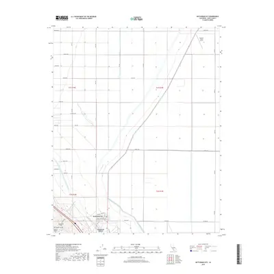
2018 Map of Kettleman City
USGS Topo · Published 2018About this map
Kettleman City sits at the southwestern edge of the fertile San Joaquin Valley, where the flat agricultural basin meets the rising slopes of the Kettleman Hills. This 2018 survey illustrates the critical water infrastructure supporting the region's industry, including the massive Governor Edmund G Brown California Aqueduct and the diagonal course of the Blakeley Canal. The map reveals a landscape defined by a rigid grid of avenues such as Newton Ave and Quebec Ave, punctuated by specialized industrial and logistical markers like Kettleman Station and General Petroleum Ave. To the north, the Westlake Farms Airport serves the surrounding commercial farm operations, while the seasonal drainage of Arroyo Degollado cuts through the western foothills, providing a clear picture of how water management and topography dictate settlement patterns in this part of Kings County.
Find a feature on this map
36 named features on this map. Tap any name to fly to it.
Don’t see what you’re looking for? This feature index may not catch every label — zoom into the map to look around manually.
Map Details
Editions of this 2018 Kettleman City Map
This is the sole edition of this map. No revisions or reprints were ever made.
Other maps of this area

1912 · Coalinga
USGS Topo · 1:125,000

1914 · Lost Hills
USGS Topo · 1:125,000

1914 · Cholame
USGS Topo · 1:125,000

1915 · Cholame
USGS Topo · 1:125,000

1917 · Cholame
USGS Topo · 1:125,000

1929 · Stratford
USGS Topo · 1:31,680

1929 · Westhaven
USGS Topo · 1:31,680

1930 · Discovery Well
USGS Topo · 1:31,680

1930 · Kettleman Plain
USGS Topo · 1:31,680

1930 · Middle Dome
USGS Topo · 1:31,680