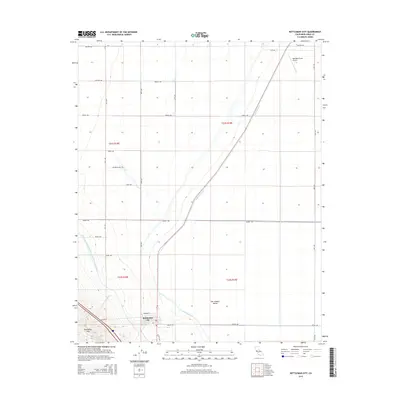
2015 Map of Kettleman City
USGS Topo · Published 2015About this map
Kettleman City sits at the southwestern edge of the San Joaquin Valley, where the flat agricultural basin meets the rising terrain of the Kettleman Hills. This landscape is defined by the massive infrastructure required to move water through the arid valley, most notably the Governor Edmund G Brown California Aqueduct and the Blakeley Canal which cut diagonally across the terrain. The town's grid is small and compact, centered around streets like Milham St and Edward St, while the surrounding land is divided into large rectangular sections typical of industrial-scale farming. To the north, the Westlake Farms Airport serves the area's agricultural needs. Natural drainage is marked by features like the Arroyo Degollado, which carves through the hills toward the valley floor, illustrating the contrast between the engineered water systems and the natural topography of Kings County.
Find a feature on this map
24 named features on this map. Tap any name to fly to it.
Don’t see what you’re looking for? This feature index may not catch every label — zoom into the map to look around manually.
Map Details
Editions of this 2015 Kettleman City Map
This is the sole edition of this map. No revisions or reprints were ever made.
Other maps of this area

1912 · Coalinga
USGS Topo · 1:125,000

1914 · Lost Hills
USGS Topo · 1:125,000

1914 · Cholame
USGS Topo · 1:125,000

1915 · Cholame
USGS Topo · 1:125,000

1917 · Cholame
USGS Topo · 1:125,000

1929 · Stratford
USGS Topo · 1:31,680

1929 · Westhaven
USGS Topo · 1:31,680

1930 · Discovery Well
USGS Topo · 1:31,680

1930 · Kettleman Plain
USGS Topo · 1:31,680

1930 · Middle Dome
USGS Topo · 1:31,680