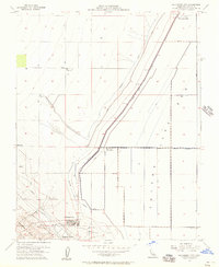
1954 Map of Kettleman City
USGS Topo · Published 1957About this map
Kettleman City stands at the foot of the Kettleman Hills in this mid-century portrait of the San Joaquin Valley’s agricultural and industrial infrastructure. The landscape is dominated by the vast, dry expanse of the Tulare Lake Bed, which is etched with a network of irrigation controls including the Blakeley Canal, multiple Levee systems, and various unnamed Ditch segments. This engineering reflects the region’s intensive water management practices directed by Harvey O. Banks.
Find a feature on this map
28 named features on this map. Tap any name to fly to it.
Don’t see what you’re looking for? This feature index may not catch every label — zoom into the map to look around manually.
Map Details
Editions of this 1954 Kettleman City Map
This is the sole edition of this map. No revisions or reprints were ever made.
Other maps of this area

1912 · Coalinga
USGS Topo · 1:125,000

1914 · Lost Hills
USGS Topo · 1:125,000

1914 · Cholame
USGS Topo · 1:125,000

1915 · Cholame
USGS Topo · 1:125,000

1917 · Cholame
USGS Topo · 1:125,000

1929 · Stratford
USGS Topo · 1:31,680

1929 · Westhaven
USGS Topo · 1:31,680

1930 · Discovery Well
USGS Topo · 1:31,680

1930 · Kettleman Plain
USGS Topo · 1:31,680

1930 · Middle Dome
USGS Topo · 1:31,680