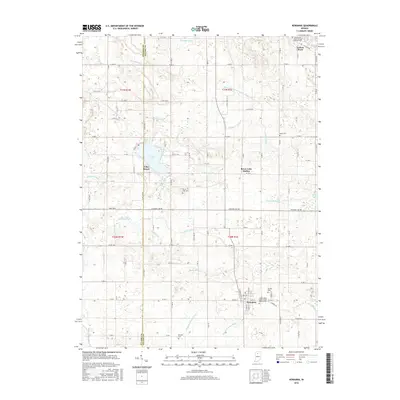
2016 Map of Kewanna
USGS Topo · Published 2016About this map
The town of Kewanna anchors the southern landscape of this Fulton County region, where the intersection of local routes and agricultural infrastructure defines the community. To the north, Leiters Ford sits near the upper margins, while the area surrounding Bruce Lake serves as a secondary focal point for settlement, including the neighborhood of Bruce Lake Station. This 2016 survey illustrates a highly modified drainage system essential for the surrounding farmland, featuring an extensive network of man-made waterways such as Slonaker Ditch, Troutman Hogan Ditch, and Bailey Ditch Arm Number Three. These channels, alongside natural features like Little Mill Cr, reflect a century of water management in northern Indiana. Genealogists will find several burial grounds preserved in the landscape, including the Independent Order of Odd Fellows Cem, the Shaffer Cem, and the Barnett Cem, providing clear evidence of the area's long-established family roots.
Find a feature on this map
76 named features on this map. Tap any name to fly to it.
Don’t see what you’re looking for? This feature index may not catch every label — zoom into the map to look around manually.
Map Details
Editions of this 2016 Kewanna Map
This is the sole edition of this map. No revisions or reprints were ever made.
Other maps of this area

1953 · Chicago
USGS Topo · 1:250,000

1953 · Danville
USGS Topo · 1:250,000

1955 · Danville
USGS Topo · 1:250,000

1956 · Danville
USGS Topo · 1:250,000

1957 · Chicago
USGS Topo · 1:250,000

1960 · Fulton
USGS Topo · 1:24,000

1960 · Grass Creek
USGS Topo · 1:24,000

1962 · Pershing
USGS Topo · 1:24,000

1962 · Winamac
USGS Topo · 1:24,000

1962 · Star City
USGS Topo · 1:24,000