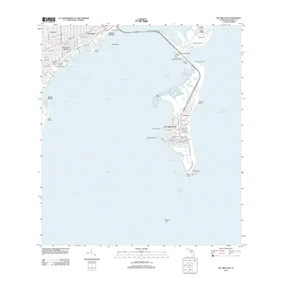
2012 Map of Key Biscayne
USGS Topo · Published 2012About this map
Cape Florida anchors the southern tip of this barrier island landscape, where the Cape Florida Old Lighthouse Tower and Cape Florida Light serve as enduring coastal landmarks. The island is defined by its recreation and maritime infrastructure, featuring Crandon Beach to the east and a series of harbors including Hurricane Harbor and No Name Harbor. To the north, the William M Powell Bridge connects the mainland at Brickell Hammock to Virginia Key, which houses the University of Miami Marine Campus.
Find a feature on this map
77 named features on this map. Tap any name to fly to it.
Don’t see what you’re looking for? This feature index may not catch every label — zoom into the map to look around manually.
Map Details
Editions of this 2012 Key Biscayne Map
This is the sole edition of this map. No revisions or reprints were ever made.
Other maps of this area

1947 · Key Biscayne
USGS Topo · 1:24,000

1948 · Soldier Key
USGS Topo · 1:24,000

1949 · Key Biscayne
USGS Topo · 1:24,000

1949 · Perrine
USGS Topo · 1:24,000

1950 · Hialeah
USGS Topo · 1:24,000

1950 · Miami
USGS Topo · 1:24,000

1950 · South Miami
USGS Topo · 1:24,000

1956 · Perrine
USGS Topo · 1:24,000

1956 · South Miami
USGS Topo · 1:24,000
1956 · Soldier Key
USGS Topo · 1:24,000