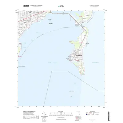
2021 Map of Key Biscayne
USGS Topo · Published 2021About this map
Coconut Grove and the residential clusters of South Bay Estates and The Pines anchor the mainland coast, separated from the barrier islands by the expanse of Biscayne Bay. The Rickenbacker Cswy provides the primary transit artery, connecting the mainland to Virginia Key and the village of Key Biscayne. This modern landscape is defined by its sophisticated water management and recreational infrastructure, featuring the Florida Circumnavigational Paddling Trl and the Bill Baggs Cape Florida State Park Trl winding through the southern tip of the island.
Find a feature on this map
53 named features on this map. Tap any name to fly to it.
Don’t see what you’re looking for? This feature index may not catch every label — zoom into the map to look around manually.
Map Details
Editions of this 2021 Key Biscayne Map
This is the sole edition of this map. No revisions or reprints were ever made.
Other maps of this area

1947 · Key Biscayne
USGS Topo · 1:24,000

1948 · Soldier Key
USGS Topo · 1:24,000

1949 · Key Biscayne
USGS Topo · 1:24,000

1949 · Perrine
USGS Topo · 1:24,000

1950 · Hialeah
USGS Topo · 1:24,000

1950 · Miami
USGS Topo · 1:24,000

1950 · South Miami
USGS Topo · 1:24,000

1956 · Perrine
USGS Topo · 1:24,000

1956 · South Miami
USGS Topo · 1:24,000
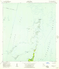
1956 · Soldier Key
USGS Topo · 1:24,000