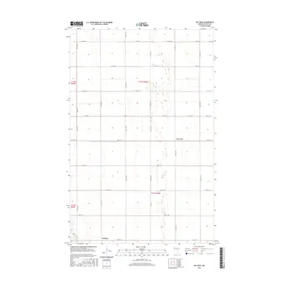
2016 Map of Key West
USGS Topo · Published 2016About this map
Key West and Davidson anchor this agricultural landscape in Polk County, where the topography is defined by the extensive drainage systems required for Red River Valley farming. The most prominent of these is the County Ditch Number One Hundred Twentysix, which cuts a straight east-west line across the central plains. This 2016 survey illustrates the persistent grid of the Public Land Survey System, with a dense network of local roads such as 160th St SW and Co Hwy 19 following section lines. For local historians and genealogists, the Nesbit Cem in the southwestern corner provides a specific point of interest, situated near the intersection of 200th St SW and 380th Ave SW. The map reflects the enduring rural character of northwestern Minnesota, where small settlements serve as vital hubs for the surrounding prairie homesteads.
Find a feature on this map
22 named features on this map. Tap any name to fly to it.
Don’t see what you’re looking for? This feature index may not catch every label — zoom into the map to look around manually.
Map Details
Editions of this 2016 Key West Map
This is the sole edition of this map. No revisions or reprints were ever made.
Other maps of this area

1918 · Angus
USGS Topo · 1:62,500

1918 · Warren
USGS Topo · 1:62,500

1952 · Grand Forks
USGS Topo · 1:250,000

1952 · Thief River Falls
USGS Topo · 1:250,000

1953 · Crookston
USGS Topo · 1:62,500

1955 · Warren
USGS Topo · 1:62,500

1956 · Thief River Falls
USGS Topo · 1:250,000

1956 · Grand Forks
USGS Topo · 1:250,000

1957 · Thief River Falls
USGS Topo · 1:250,000
1961 · Angus
USGS Topo · 1:24,000