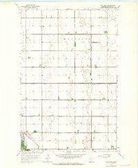
1963 Map of Key West
USGS Topo · Published 1964About this map
Keystone and Huntsville townships characterize the orderly grid of the Red River Valley as it appeared in the early 1960s. This agricultural landscape in Polk County is defined by an extensive drainage system, including County Ditch No 126 and County Ditch No 38, which reclaimed the flat prairie for farming. The Northern Pacific railroad runs diagonally through the southern sections, anchoring small rail-stop settlements like Key West and Davidson. In the southwest corner, the winding path of Grand Marais provides a natural contrast to the strictly surveyed section lines. Local history is anchored by the Nesbit Cem, located near the junction of Nesbit and Sullivan townships, serving as a permanent record of the families who settled this productive corner of Minnesota.
Find a feature on this map
17 named features on this map. Tap any name to fly to it.
Don’t see what you’re looking for? This feature index may not catch every label — zoom into the map to look around manually.
Map Details
Editions of this 1963 Key West Map
This is the sole edition of this map. No revisions or reprints were ever made.
Other maps of this area

1918 · Angus
USGS Topo · 1:62,500

1918 · Warren
USGS Topo · 1:62,500

1952 · Grand Forks
USGS Topo · 1:250,000

1952 · Thief River Falls
USGS Topo · 1:250,000

1953 · Crookston
USGS Topo · 1:62,500

1955 · Warren
USGS Topo · 1:62,500

1956 · Thief River Falls
USGS Topo · 1:250,000

1956 · Grand Forks
USGS Topo · 1:250,000

1957 · Thief River Falls
USGS Topo · 1:250,000
1961 · Angus
USGS Topo · 1:24,000