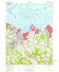
1954 Map of Keyport
USGS Topo · Published 1962About this map
The coastal landscape of Monmouth County is defined by its deep-water access and burgeoning suburban corridors in the mid-1950s. Keyport sits as a central hub on Keyport Harbor, while the Garden State Parkway and State Highway 35 drive development southward through Hazlet and Matawan. The influence of the New York and Long Branch railroad is evident, connecting shoreline communities like Laurence Harbor and Cliffwood Beach to the metropolitan region. Inland, the terrain rises toward Telegraph Hill and Red Hill, where a more rural character persists through named crossroads like Hendrickson Corners and Morrell Corners. This period shows the transition from an economy of gravel pits and clay pits to one of residential expansion, evidenced by the numerous cemeteries including Rose Hill Cem and Mt Union Cem that mark the established family history of the area.
Find a feature on this map
86 named features on this map. Tap any name to fly to it.
Don’t see what you’re looking for? This feature index may not catch every label — zoom into the map to look around manually.
Map Details
Editions of this 1954 Keyport Map
4 editions found
Other maps of this area

1888 · Plainfield
USGS Topo · 1:62,500

1888 · New Brunswick
USGS Topo · 1:62,500

1888 · Sandy Hook
USGS Topo · 1:62,500

1893 · New Brunswick
USGS Topo · 1:62,500

1893 · Plainfield
USGS Topo · 1:62,500

1893 · Sandy Hook
USGS Topo · 1:62,500

1898 · Plainfield
USGS Topo · 1:62,500

1898 · Staten Island
USGS Topo · 1:62,500

1900 · Passaic
USGS Topo · 1:125,000

1900 · Staten Island
USGS Topo · 1:62,500