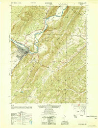
1950 Map of Keyser
USGS Topo · Published 1954About this map
Keyser serves as the industrial and population hub of this 1950s survey, situated along the winding banks of the North Branch Potomac River. The town's growth and layout are deeply tied to the heavy presence of the Baltimore and Ohio and Western Maryland railroads, which parallel the water and define the transport corridors through the Potomac Valley. This mid-century view captures the area as it transitioned through the post-war era, with clear demarcations between the urban center and the surrounding agricultural and rural landmarks like the County Farm and Wilson Community Hall.
Find a feature on this map
48 named features on this map. Tap any name to fly to it.
Don’t see what you’re looking for? This feature index may not catch every label — zoom into the map to look around manually.
Map Details
Editions of this 1950 Keyser Map
This is the sole edition of this map. No revisions or reprints were ever made.
Other maps of this area

1891 · Romney
USGS Topo · 1:125,000

1895 · Piedmont
USGS Topo · 1:125,000

1898 · Frostburg
USGS Topo · 1:62,500

1899 · Grantsville
USGS Topo · 1:62,500

1901 · Frostburg
USGS Topo · 1:62,500

1904 · Grantsville
USGS Topo · 1:62,500

1908 · Frostburg
USGS Topo · 1:62,500

1919 · Elk Garden
USGS Topo · 1:48,000

1920 · Elk Garden
USGS Topo · 1:48,000

1920 · Keyser
USGS Topo · 1:62,500